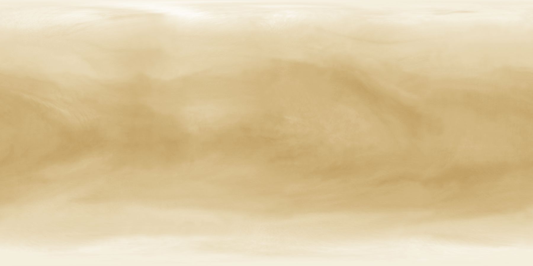
A map of Venus
This map of Venus was created from images taken by the Galileo spacecraft during its Venus flyby in 1990. A total of 21 images were used. These images were projected onto a cylindrical map and the resulting mosaic cleaned up using mainly Photoshop. Finally it was colorized. The resulting map shows features visible in ultraviolet light, in visible light the contrast is much lower so almost no features are visible. Also for ultimate reality, the color should probably be almost completely white, maybe with a slight yellowish tint. Still I think this map is more realistic than other maps I have seen of Venus on the web, the clouds in these other maps are oriented east-west which is inaccurate and looks more like the gas giants than Venus.
The map is in simple cylindrical projection with latitudes running with a uniform interval from -90 (bottom) to 90 (top). The longitude range is 0-360 degrees but since the clouds are constantly changing the 0° longitude has no specific location in the map. The map should be rendered by projecting it onto a sphere of about 6115 km radius or equivalent unit. Actually Venus' solid body radius is 6051 km but the height of the cloudtops is approximately 65 km so 6115 km seems to be an appropriate value.
Click the map below to view the 1800x900 pixel full size version (58 KB).