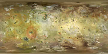
A map of Io
This map of Io was created by composing approximately 60 images from the Voyager 1 spacecraft and 40 images from the Galileo spacecraft into a big monochrome map. The images were selected to get as high/uniform resolution resolution across the map as possible. The map was then colorized by taking the color from various Galileo color images and mosaics, many of them at lower resolution than the monochrome map. I didn't use any color data from the Voyager spacecraft since it is of much lower quality than the Galileo color data. I then corrected the color because Galileo's camera system didn't include a blue filter; instead it had a violet filter. The correction is comparable to what I described here, except that I didn't change the color and saturation as much as described there. The reason is that the Voyager blue filter (which I originally used to determine the correction) really is rather close to cyan; a filter with a somewhat shorter wavelength would have been better for true color work. The result here is color that is considerably more saturated than in the original correction but still less so than in Galileo imagery that hasn't been corrected.
Finally I replaced small, black areas near the poles (where no imagery is available) with fictional data created by cloning adjacent areas.
Click the map below to view the 3600x1800 full size map.