


Stereo magic: A DEM of Rhea
Unlike Jupiter's satellites it is not possible to get acceptable renderings of Saturn's icy satellites without using a digital elevation model (DEM). The main reason is that the craters on Saturn's satellites are far bigger and deeper relative to the satellites than the craters (and topography in general) on Jupiter's satellites. So even though using only a texture map works well in the majority of cases for Jupiter's satellites it is not an acceptable option when rendering Saturn's satellites.
Years ago I wrote primitive shape from shading software to generate a crude DEM of Mimas but I was never happy enough with the result. The biggest problem was horizontal lines. Once Cassini arrived at Saturn sufficient coverage became available of its satellites to attempt something else: Using stereo imagery to generate DEMs. This required a lot of work, much of which involved software development and various optimizations because early versions of my stereo software were far too slow. I used images of Rhea since it has the best global imaging coverage of any of Saturn's satellites. Once things started working properly I realized there was enough coverage for a near-global DEM of Rhea.
After a lot of work I now have an almost global DEM of Rhea. Only the north polar region and small spots closer to the equator are missing. Hopefully most of these gaps can be filled from future Cassini imagery.
Since Rhea's brightness and albedo isn't completely uniform the final step required to get realistic renderings was to create a color and albedo map. That map is available here.
What remains is to fill the DEM's gaps, hopefully with future imaging data. The resolution of the DEM also isn't uniform and parts of it look noisy. The only way to fix some of these problems is lots and lots of work in Photosop.
A few renderings showing the DEM's progress:
|
|
|
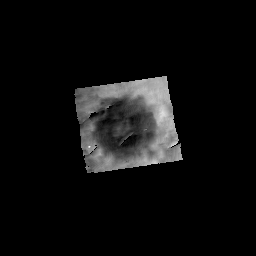
| Obviously something's wrong here. This "DEM" was generated using a very early (and buggy) version of my stereo software back in 2007. | Here it almost works There are some ugly artifacts there but a crater is obvious. | It works!! The crater in the previous image can be seen slightly to the right of and below center. There is some annoying "contouring" and the software was still terribly slow but at this point I finally became convinced that I would get something useful out of this thing. Click the image for a full size version. |
|
|
|
| One of two source images used to generate the DEM. The area covered by the DEM is outlined. Click the image for a full size version. | The other source image. Needless to say the viewing geometry is a bit different. Click the image for a full size version. | A rendering showing the DEM. The rendering looks "contoured", an annoying problem that persisted for some time. Click the image for a full size version. |
|
|
|
| Here the "contouring" problem has been fixed and the DEM covers a fairly big part of Rhea. Click the image for a full size version. | "Rhea under construction": The fact that the viewing geometry information for the source images isn't 100% accurate caused some problems. Click the image for a full size version. | Here the DEM has become almost global, seams have been removed and the color and albedo map has been completed. The result looks fairly realistic but the DEM still requires some work in Photoshop. Click the image for a full size version. |